Stonehenge
Sighting the Sun
by Clive Ruggles and Amanda Chadburn
Supplementary online materials
Additional photographs and plans
Contents of this page:
Larger versions of graphical illustrations
It was not possible to reproduce some of Sharon Soutar’s graphical illustations at full size in the book because of formatting constraints. Click on the thumbnails below to view these at full resolution. Please note that none of them may be reproduced without permission.
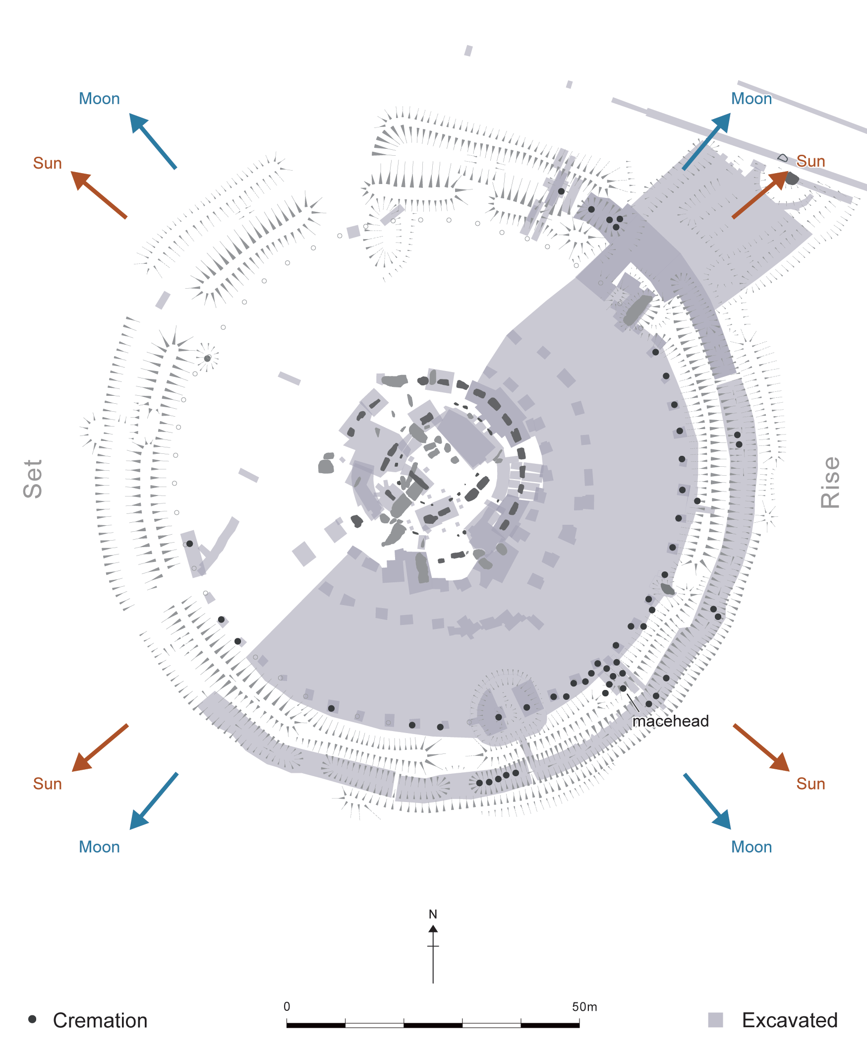

Contour plans of Durrington Walls (cf. Fig. 6.10 [p. 95])
The following contour plans have kindly been produced from the LiDAR data by Phil Barrett, and reveal subtle details that are not visible in Fig. 6.10, such as the dry valley leading down to the River Avon around which the henge monument was built (see p. 92). Importantly, they also clearly show (towards the top left) the broad rounded hilltop that marks the end of Sightline 2 from Stonehenge (see p. 71 and Figs 7.2a and b). This hill has near 360° views as can be seen in Fig. 4.5—it forms the end of the Lark Hill Ridge. (Because of its extensive radial views, the unnamed hill was nicknamed ‘the panopticon’ by the Stonehenge Riverside Project.)
Note that neither the A345 road on its embankment, nor the old road, have been digitally removed as they have in Fig 6.10. (For how this was done, see here.)
There are three plans, at different contour resolutions (40 cm, 25 cm and 20 cm). In each case, every fifth contour line is colured white while the remainder are coloured red. Click on the thumbnails to view them at full resolution.
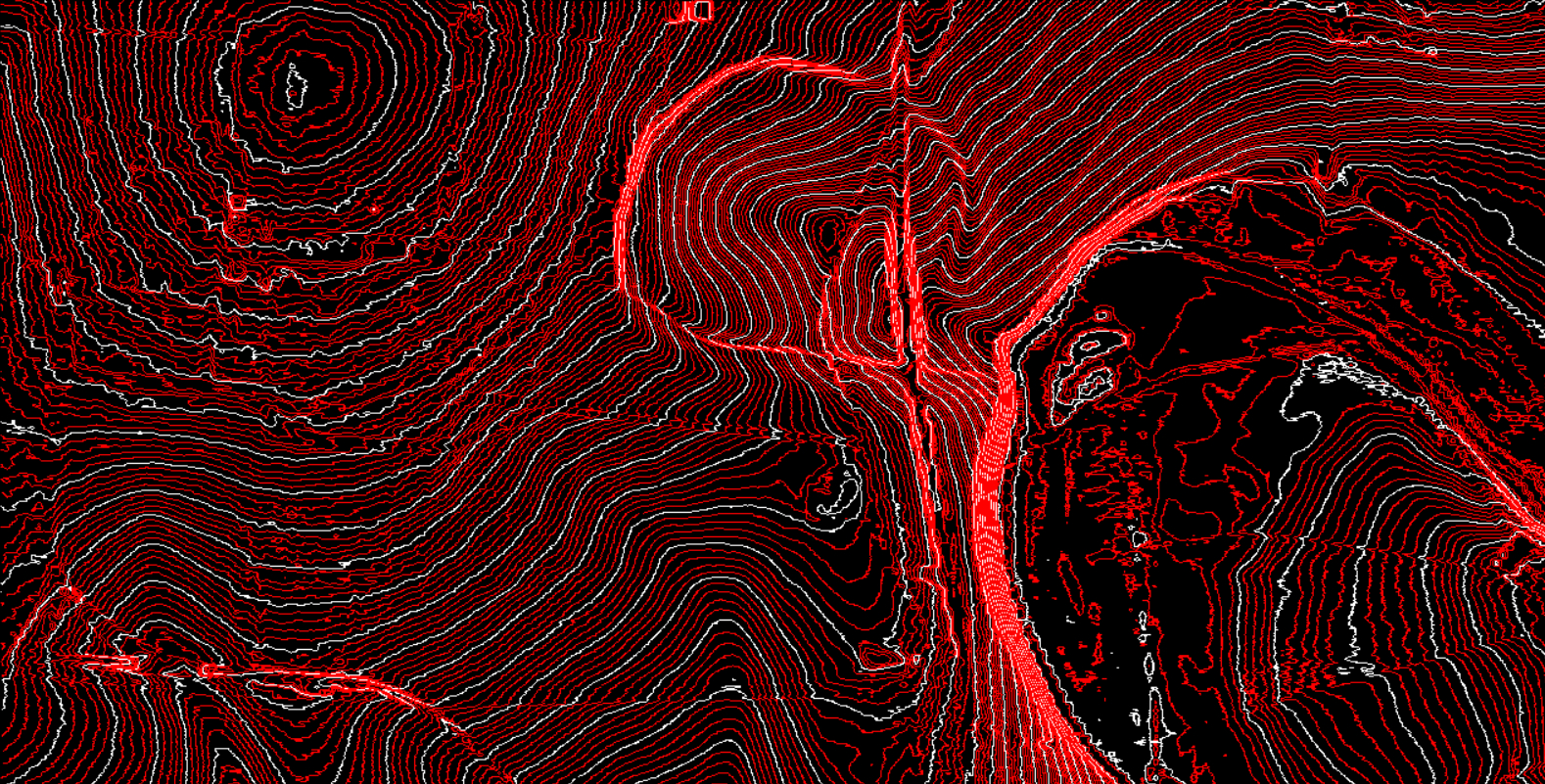
40-cm resolution
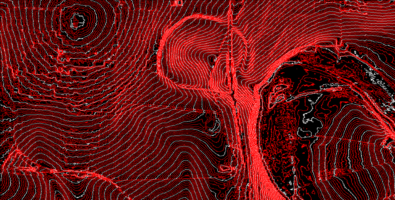
25-cm resolution
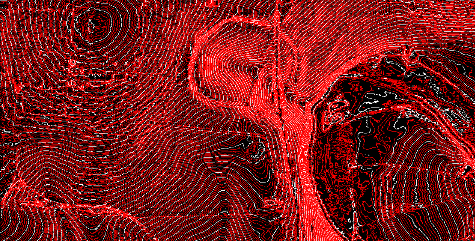
20-cm resolution
Sunrise over Sidbury Hill (cf. Fig. 7.3 [p. 108])
Below is a further picture taken by Matt Leivers of solstice sunrise over Sidbury Hill as viewed from Lark Hill, this time in near-perfect conditions on the morning of June 21, 2024, at the moment when the full sun appeared to be just sitting on the horizon.
Click on the thumbnail to view the image at full resolution.
Stanton Drew (cf. Fig. B10.2.2 [p. 155]
Below is a larger version of the picture showing the view south-westwards from the centre of the North-East Circle (Fig. B10.2.2). AC (in red), marking the axis, is highlighted by the yellow arrow. The second picture shows this in close-up. The third picture shows the axis marked in yellow superimposed upon a GoogleEarth image of the site.
Click on the thumbnails to view each image at full resolution.
Close-up
GoogleEarth image
Other supplementary on-line materials