Heiau, ‘Āina, Lani
Supplementary online materials
Additional figures
Site KAU-324 (Pōpōiwi Heiau)
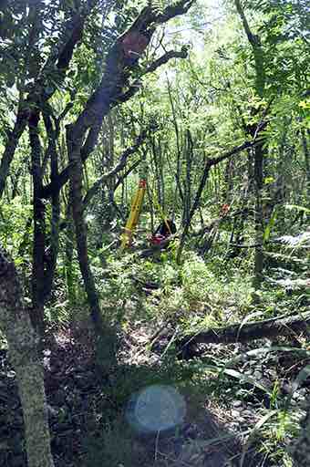
The dense vegetation covering Pōpōiwi Heiau in 2011. (Photo by Clive Ruggles)
Notes
- For a site plan see figure 8.16 in the book.
- Figure 3.15 in the book shows an OxCal plot of radiocarbon dates obtained by M. Kolb from excavations at Pōpōiwi Heiau.
- Figure 8.17 in the book shows a DTM-generated profile of the horizon to the north as seen from Pōpōiwi Heiau, with a horizontal bar indicating the principal direction of orientation of the features in the northern terrace.
- For orientation data see the Additional tables page.
- For all-round horizon profiles at this site see the All-round profiles page.

Return to the Additional figures page