Heiau, ‘Āina, Lani
Supplementary online materials
Additional figures
Site KIP-1146
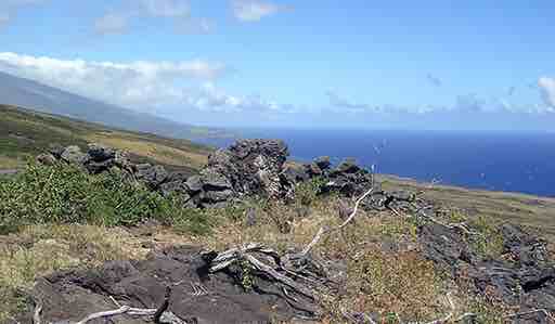
The upright stone (A) at KIP-1146 as viewed from the leveled area (B), with Ka Lae o Ka ‘Ilio directly behind it. (Photo by Clive Ruggles; colour version of figure 7.32 in the book)
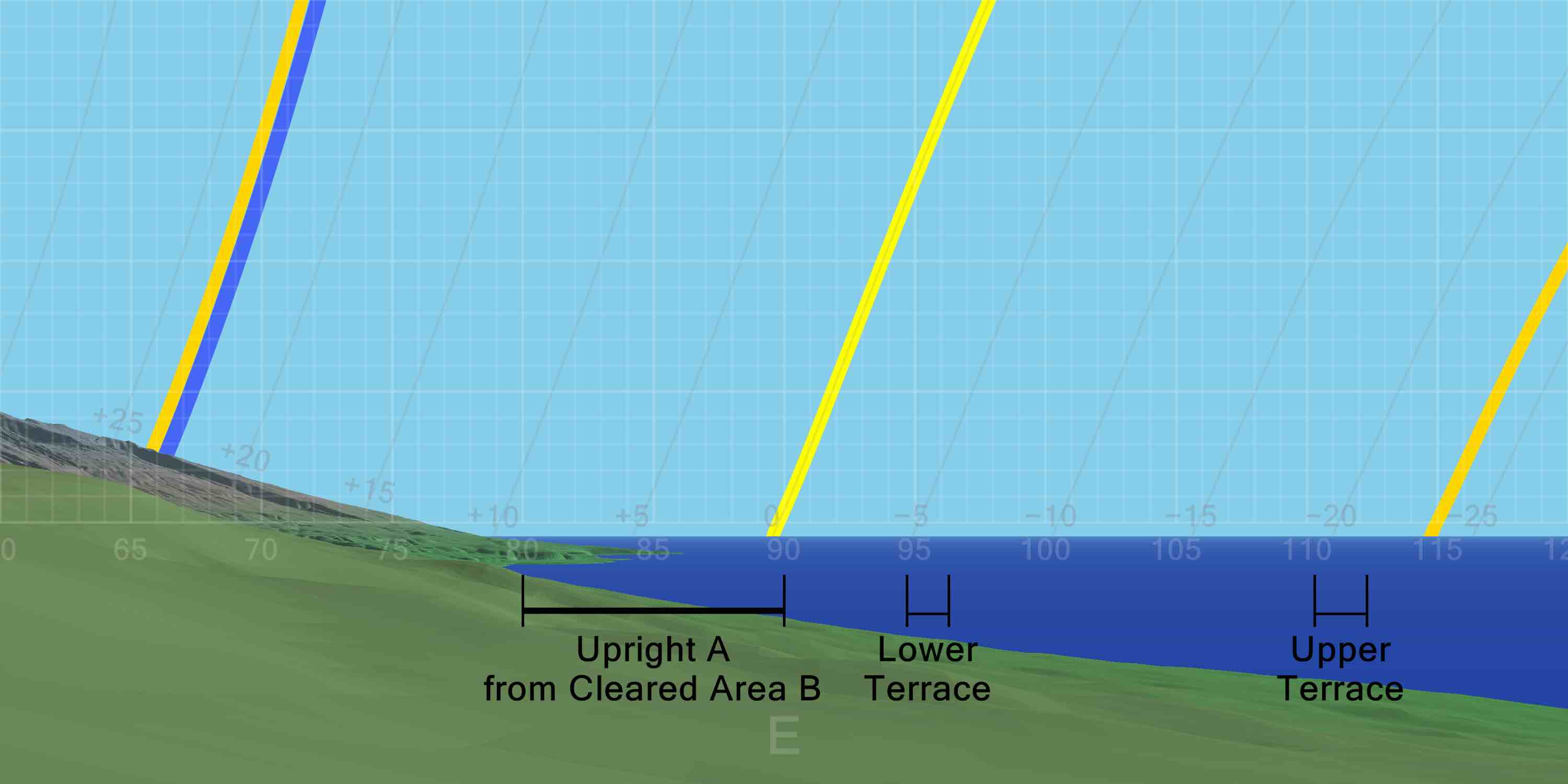 DTM-generated profile of the horizon to the east as seen from site KIP-1146. The horizontal bars indicate the direction of orientation of the upright A when viewed from the small cleared area B, and of the terraces. The darker yellow lines indicate the rising paths of the sun at the June solstice (left) and December solstice (right); the lighter yellow line indicates the rising path of the sun at the equinoxes; and the blue line indicates the rising path of the Pleiades in A.D. 1600. (Graphic by Andrew Smith; colour version of Figure 7.33 in the book)
Notes
- For a site plan see figure 7.31 in the book.
- Figure 4.14 in the book shows the upright stone (A) at KIP-1146 as viewed from the leveled area (B), and Ka Lae o Ka ‘Ilio directly behind, as in figure 7.32, superimposed upon a DTM-generated profile of the eastern horizon, as in figure 7.33.
- For all-round horizon profiles at this site see the All-round profiles page.
- For dates of sunrise in directions of possible significance, see table 7.3 in the book.

Return to the Additional figures page