
Heiau, ‘Āina, Lani
Supplementary online materials
Additional figures
Site KIP-1025
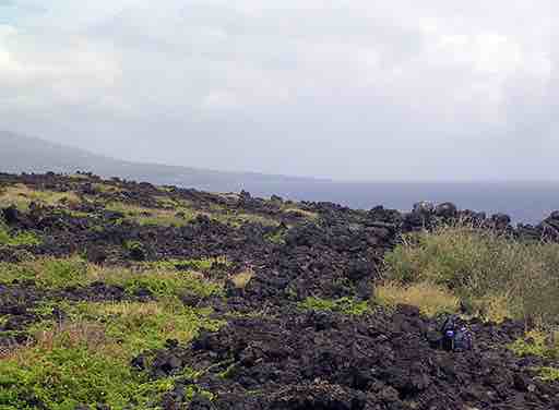
View eastward along the N wall. (Photo by Clive Ruggles)
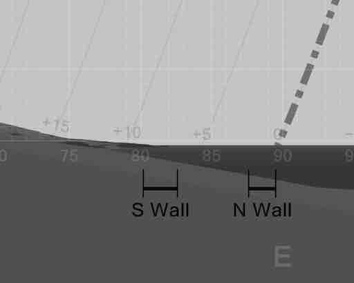
DTM-generated profile of the horizon to the east as seen from site KIP-1025. The horizontal bars indicate the direction of orientation of the N and S walls of the main enclosure. The dash-and-dot line indicates the rising path of the sun at the equinoxes. For a commentary see page 253 of the book. (Graphic by Andrew Smith)
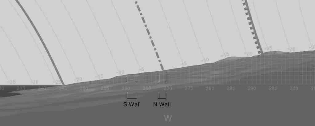
DTM-generated profile of the horizon to the west as seen from site KIP-1025. The horizontal bars indicate the direction of orientation of the N and S walls of the main enclosure. The solid shaded lines indicate the setting paths of the sun at the December solstice (left) and June solstice (right); the dash-and-dot line indicates the setting path of the sun at the equinoxes; and the dotted line indicates the setting path of the Pleiades in AD 1600. For a commentary see page 253 of the book. (Graphic by Andrew Smith)
Notes
- For a site plan see figure 7.30 in the book.
- For orientation data see the Additional tables page.
- For all-round horizon profiles at this site see the All-round profiles page.

Return to the Additional figures page